I’ve been meaning to do the Three Capes Track in Tasmania for a while now. TL;DR, it did not disappoint. From the memory-foam mattresses, to the USB phone chargers and excellent track work, you can tell a lot of thought and planning has gone into the track overall to make it as enjoyable as possible. But the real standout is the scenery—cliff lines towering hundreds of feet, dolerite galore and shimmering turquoise waters. It surely has to be one of the most scenic walks we have to offer.
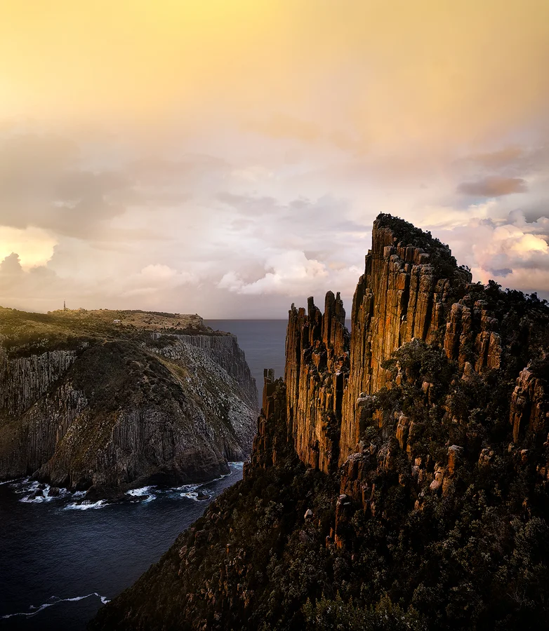
The Blade overlooking Tasman Island. You can see my friend Rob at the very top.
The track runs a span of 46km over four days, with three nights of (luxurious by hiking standards) accommodation. The walk is far from taxing. In fact, I’d hazard most of our group firmly fell into the later end of life. It’s designed in such a way you can really take your own pace, as fast or slow as you want, and I’d err on the latter if you’re looking for maximum enjoyment.
The price of admission includes entry to the Port Arthur Historic site and a boat ride to the start of the track courtesy of the excellent Pennicott Wilderness Journeys. There is talk of expanding the track to include Cape Raoul, but as its own I think it’s just about right.

The view from the helipad at one of the huts as a storm cleared.
There’s also a great deal in terms of environs. The last day in particular sees you moving through a mossy beech forest that could well be the South Island. There is almost always something to see, including a variety of keenly placed sculptures and art installations with apt names like ‘My Blood Runs Cold’.
Photography-wise, it can be a bit of a challenge. I took just one camera, the Sigma DP1, but it would have been nice to have a lens in the tele range, especially shooting from some of the huts where the capes are a bit further out.
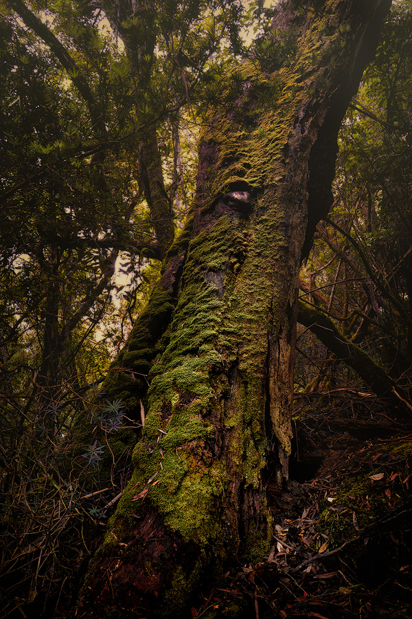
Part of the magical beech forest heading up Mt Fortescue.
The highlight was, of course, the Blade, a sharp, towering formation overlooking Tasman Island and the infinite beyond. This required a very early start the night before and a climb up in the dark and rain, but the view was well worth the effort and a must if you’re looking to capture the Blade in its best light. For astrophotography, it would be great, though the Sigma isn’t much good above ISO 100.
Having done a bit of rock climbing in the past, I was especially excited to see two young men tackle the Totem Pole at Cape Hauy while we were there, a rarity given only 20-30 climbers take it on a year. It required the lead climber to abseil right down to the water and then bridge the gap by penduluming off the main face and lunging for an anchor point, all while the swell tossed and turned only feet below. Talk about a heart-racing climb!

My favourite image from the trip showing a sudden storm moving out into the ocean. Sights like these are a regular occurance.
As for track tips, pack as much fresh food as you can, at least for the first day or two before everyone inevitably pulls out their Back Country dehy meals (never again). The kitchen facilities are excellent. I even managed to smuggle in a half-dozen fresh eggs. People were cooking up steak and vegetables, dhal, hand-made pasta… You name it.
I’d also suggest packing as light as you can, keeping in mind you can leave unwanted bulk at the Port Arthur Historic Site (at the visitor’s centre at the top, not down near the jetty). It’s a very short walk on day one, so you’re better off taking the later boat and exploring the port. The same goes for the last, and most strenuous, day to Capue Hauy and the postcard-like Fortescue Bay. The last thing you want to be doing is rushing to catch your bus.
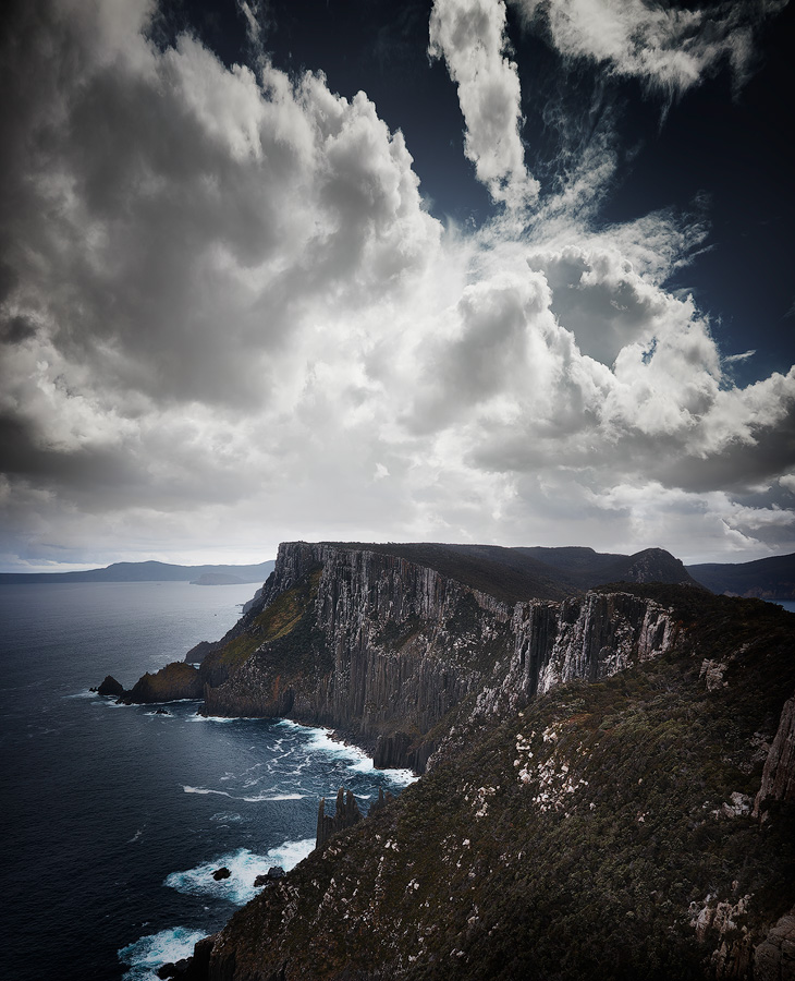
A similar view prior to the rain and storm activity.
Pack for all weather. We had everything—hail, rain, sun, storms. As it’s Tassie, the UV is a lot stronger as well, so be sure to bring ample sunscreen and a hat/long-sleeved clothing. While you’re at it, allow a day or two of R&R in Hobart. Visit MONA, eat at the Machine Laundry Cafe and take it all in. It’s a surprisingly happening part of the world.
More information HERE.

Tasman Island as seen from the very top of the Blade. I have to admit, it's a rather daunting position with the wind and exposure, but what a view!
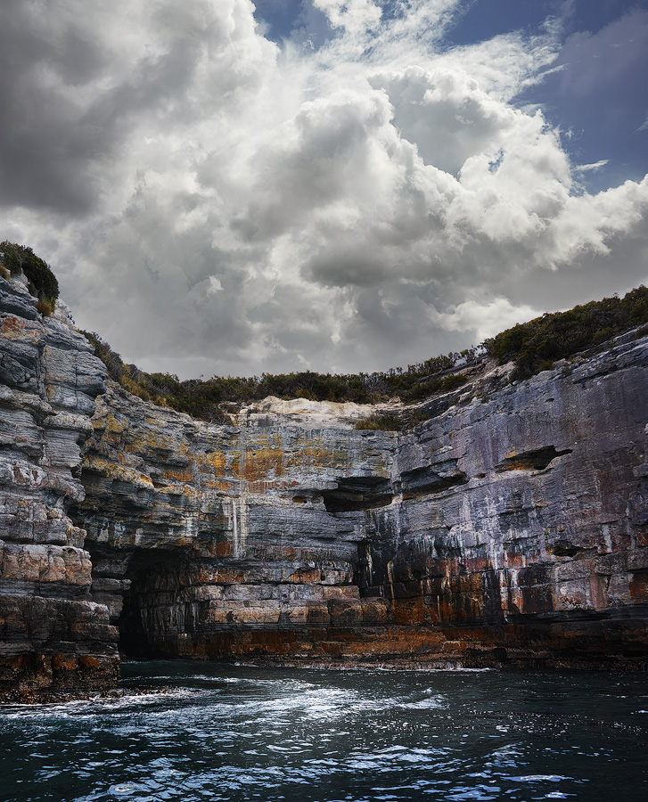
The track includes a boat tour. Here we have what our captain referred to as the 'nostril cave'.